

If you like punishing hikes with good friend's hike Mt. Sizer! Today 4/29 we summited my 8th peak of the Bay Day 6 Pack of Peaks challenge. Yes 8th and there is one more to go which I am debating about. We hiked over 15.3 miles, gained 4108 in elevation in about six hours and forty minutes.
The group hit the trail at 8am and ran right into the park ranger who cautioned us to have at least 4 liters of water for the hike. Fortunately, we are veteran hikers and were prepared for the challenges of Mt. Sizer.
The weather was already warm with a light breeze from time to time and the skys were clear. We first took the Mountain Trail to the Henry Coe Monument and then caught Hobbs Road to Frog Lake.
The flowers were out, and the grass was green for the most part. But you can tell the ground is drying up and the grass has a hint of brown. The trees were lush and gave us plenty of cover as we hiked. Lots of birds were out and we even saw a turkey who answered my turkey talk.
After a brief stop at Frog Lake, we took the Frog Late trail up to
Middle Ridge trail which reconnected us back to Hobbs Road. We took Hobbs all the way and stopped at Middle Fork Coyote Creek and took a 10 minute break. So far we had hiked 4.6 miles and now 1 of 2 hard climbs began.
From the creek up to Blue Ridge we were about to gain 1500 ft in 1.5 miles. This was a hiker road to hike up. It took us over 40 minutes to hike up the 30 degree road at times taking many breaks along the way. But once we hit the top of the ridge it was just another mile or so to the top.
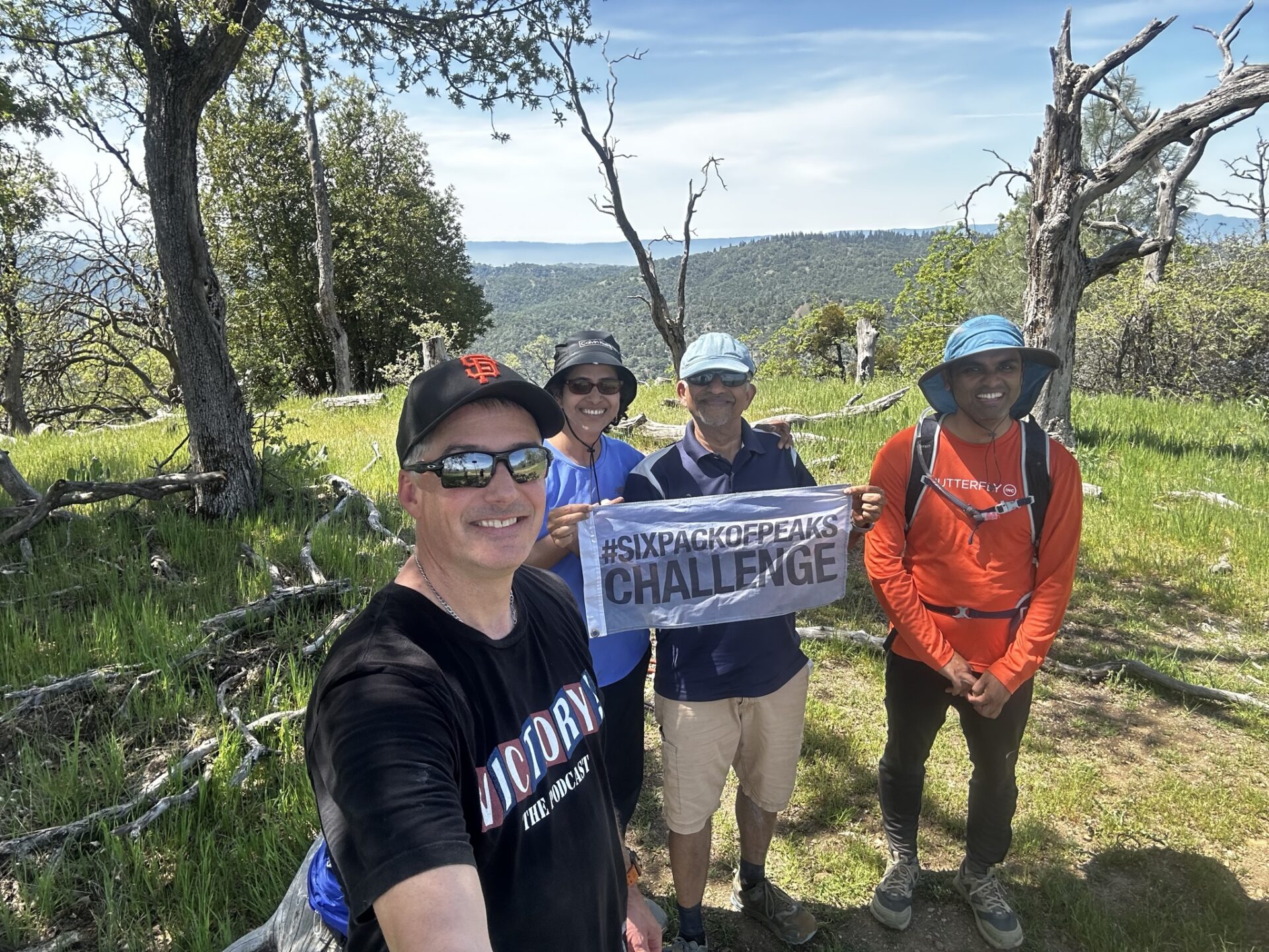
We hit the summit of Sizer at 11:15am and had lunch. The group was tired and feeling victorious. Pictures were taken and lunch enjoyed. As we were getting ready to leave a young couple summited. For the most part the trails had been empty.
We continued on Blue Ridge Road and cut over onto Jackass trail, which is poorly marked to Poverty Flat Road. We took a break at the Poverty Flat campground and then continued on.
We had to cross Middle Fork Coyote Creek again and this time the creek was wider and deeper. But after a few moments we found our way across and then hit the 2nd hardest climb of the hike. This was a simple 1.6 mile climb still on Poverty Flat Road but at least the grade was a little easier and there were more flat parts.
After the climb we connected with Manzanita Road and then cut over to the Corral Trail back to the cars. The weather stayed the same for the most part all day but when the breeze stopped it got warm. We made it and took a victory picture to celebrate!
It was a great day to be on Sizer. Thanks to all who hiked today! I have posted all the pictures and videos of my hike to this page. Also, there is a link to the All-Trails route we took. If you would like to ask more questions about my hikes, please feel free to message me and I will share all my info. If you are interested in my hikes, you can follow me on my Facebook page Jason’s Hiking Adventures and Bay Are Hikers, Instagram @jasonshikingadventures, Social Hiker, and All Trails. Thanks for reading!
All Trails Map: https://www.alltrails.com/…/afternoon-hike-897a9a2–433


Responses