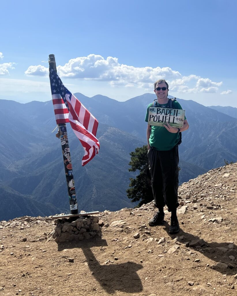

This has to be my favorite hike in the San Gabriel Mountains, and easily the nicest hike thus far in my 6 pack. Hiking up the long four miles of switchbacks on the north-east slope of Baden-Powell really feels like the high Sierra Nevada, with stunning views of the desert and nothing but gnarled pines and a good smooth trail in front of you. As many have chronicled, it’s 40 switchbacks over 4 miles and a short ridge hike to the peak, a gain of 2,800 feet. I enjoyed counting down the switchbacks; it seemed to shorten the time and certainly helped to keep me going.
I started later than I would have liked at 7:20. It’s a northeast facing slope, so you’ll get lots of sun in the morning hours, through there is ample shade on the trail. I summited about 9:30, passing two other hikers on the way, with a third coming down just as I arrived. This was on a Tuesday morning, so figure that this is a popular trail on any day, and especially on weekends. Given that the temps above 8,500 feet were in the low 70s, you’ll understand why. Just lovely to be above all the heat in the high elevation forest.
The views are just awesome. To the north and east it’s all desert – though hazy, I could see the Devil’s Punchbowl, Victorville, Lancaster, Barstow, all the way out to Mojave and Edwards Airforce Base. To the south and west, you can see Baldy, Saddleback in Orange County, the whole IE, Mt. Wilson and Strawberry Peak (my first two climbs) and even a bit of downtown LA through the marine layer/haze. But for me, the steep drops into the canyons, the near mountains, and the many gnarled old trees were most beautiful.
Now, 4 miles of switchbacks up, followed by 4 miles down would certainly have been a good workout. But whether it was the endorphins or the pleasant day, I decided to bag two more peaks on the ridgeline trail. I did this hike about 20 years ago and knew that Mt. Burnham and Throop Peak were (relatively) easy to get to from the top of BP. Indeed, you do add 3 miles out and 3 back, and drop from 9,400 at the top of BP a low of about 8,500 before heading up to Throop at 9,100 feet. You can hit the 8,993 ft. Mt. Burnham along the way by following the ridge trails. The views are great, desert to one side, mountain canyons to the other, and given the lighter foot traffic, better chance to see wildlife. I did see deer and one good sized rattler, as well as about a thousand lizards. At this altitude there are virtually no bugs, which is a really big plus. Highly recommended. Stopping frequently for snacks and to take in views, I summited Throop about noon. I was back on top of Baden-Powell by 1:30, headed down at 1:40, back in the car at 3:50. Overall, 14 miles exact with about 4,000ft. cumulative total elevation gain. I finished all 3 liters of water, and there is NO water along this trail, other than the trickle at Lamel Springs which you pass in the first couple of miles. So if you do this longer hike, take plenty of water and be judicious. Having plenty of coverage (long shirt, pants, shade hat) also necessary for the high altitude sunlight. Really great day.
Halfway through the challenge! Hoping to get a day to hike Baldy in the coming weeks.


Responses