
Mount Wilson 2025 – Solo Opening Hike
Also on this hike
Mount Wilson 2025 – Solo Opening Hike
May 19, 2025
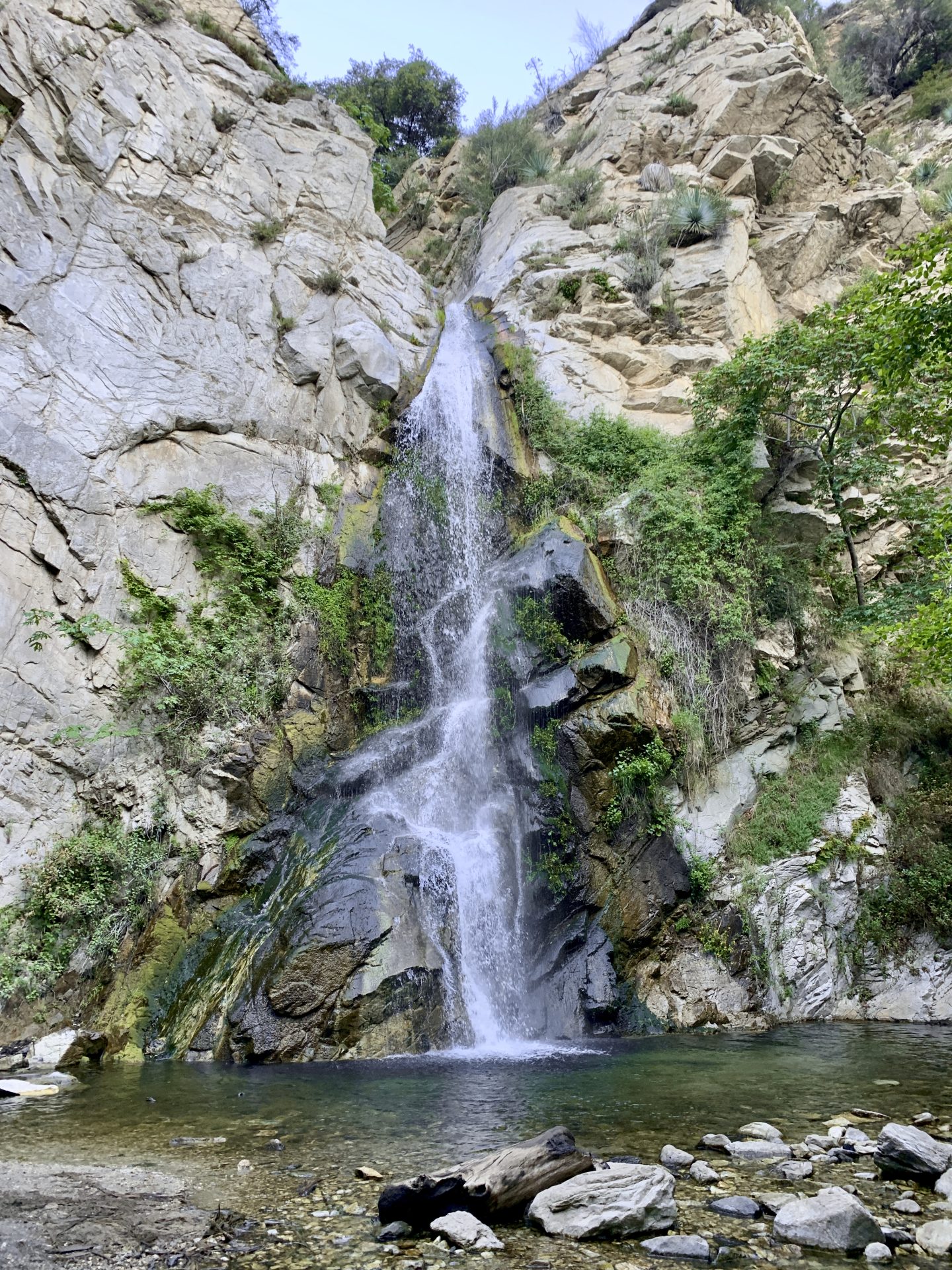
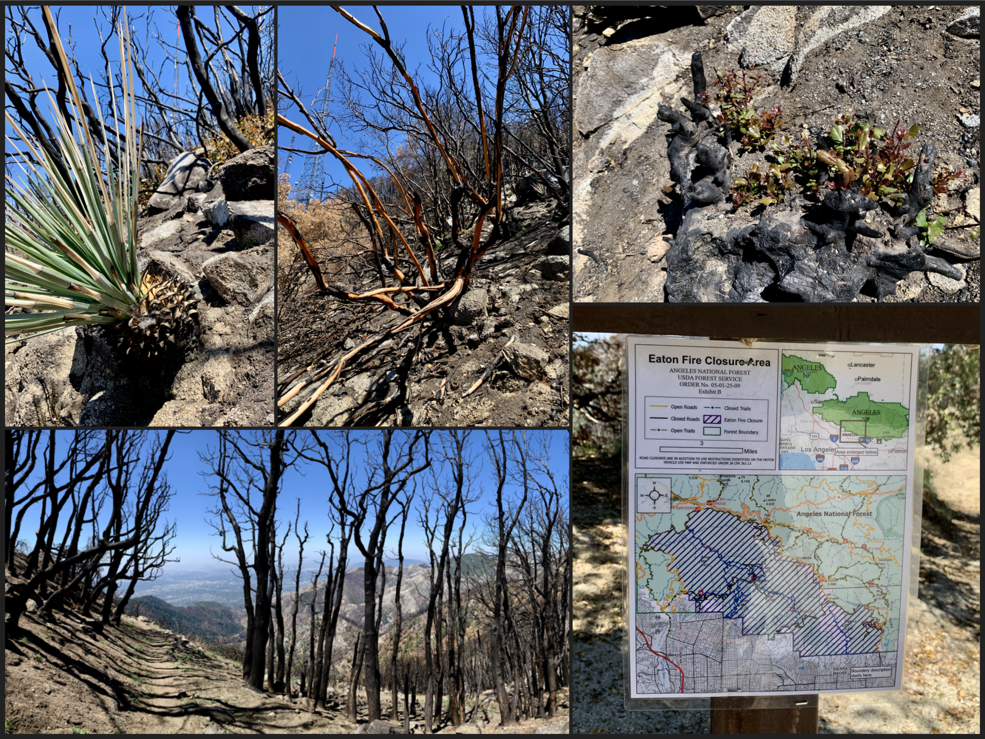
First time hiking Mount Wilson via the recently reopened Chantry Flats TH. Access to the summit via the Mount Wilson TH route is currently closed because of the Eaton Fire that devastated the area earlier this year. There are several trails you can take to get to the summit. I decided to hike the loop via the the Sturtevant Trail on the way up. The spur trail ~1.4 miles in that takes you to the Sturtevant Falls is well worth the small detour – it’s only an extra 0.5 miles out-and-back from the Lower Gabrielino junction.
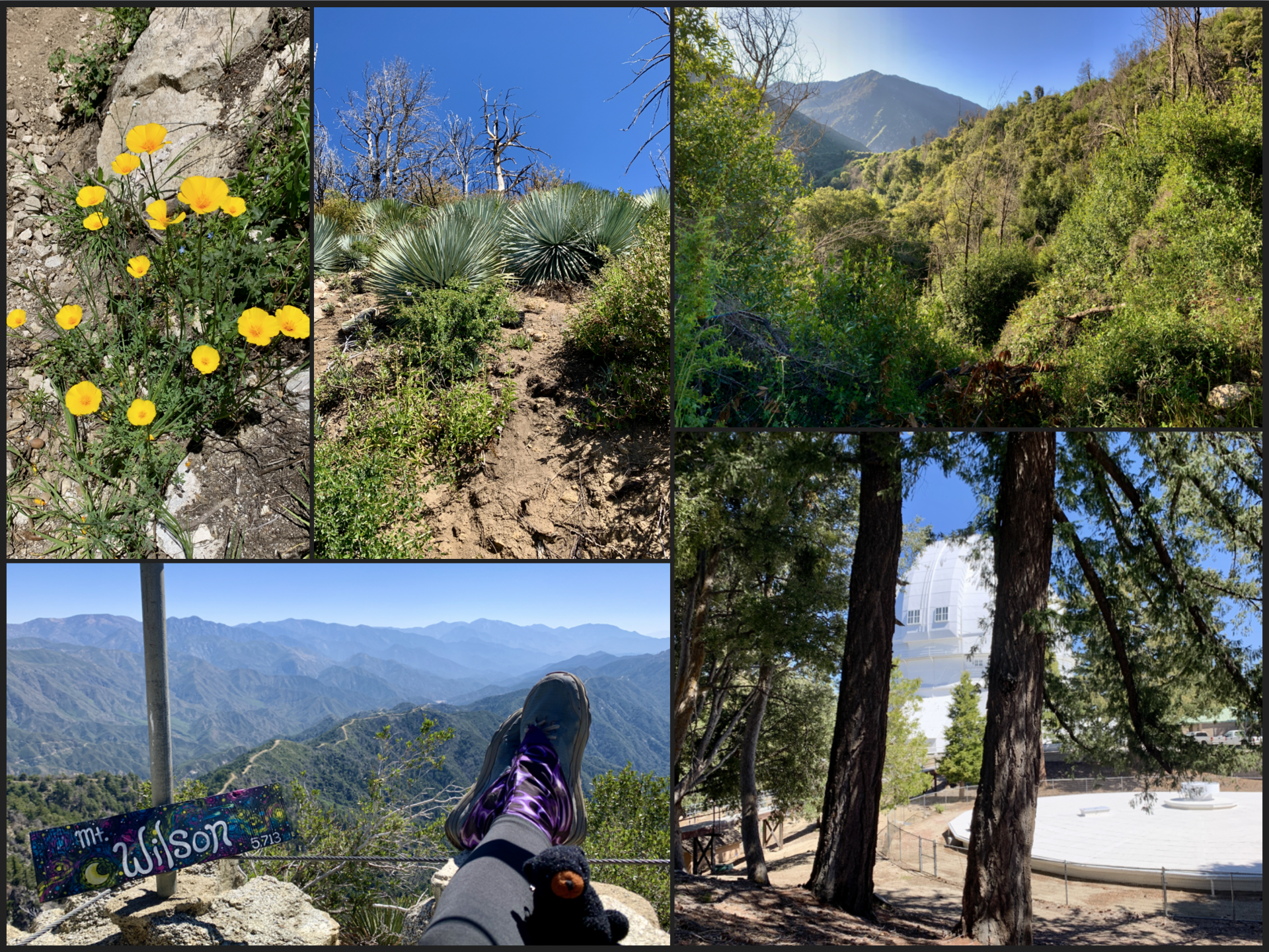
The Observatory complex at the top was quiet on a weekday. Geeking out an astronomy while taking a lunch break never gets old. 🙂
On the way back down, the first 3/4 mile down from the observatory parking lot takes you through the very edge of the burn scar from the Eaton fire until you can rejoin the Winter Creek trail. It was shocking to see the level of devastation on the mountain. Thankfully, you can already see some signs of regrowth after just a few months but there is a long road to recovery ahead.
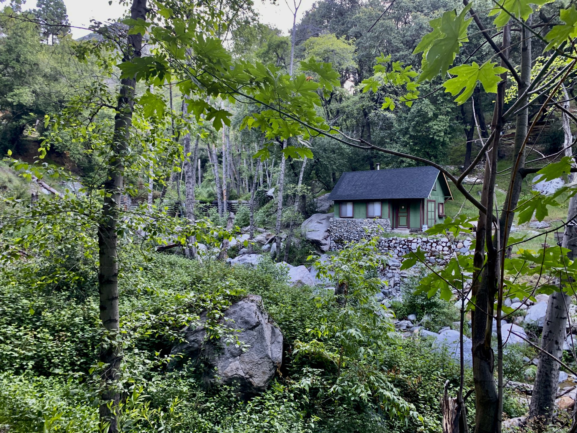
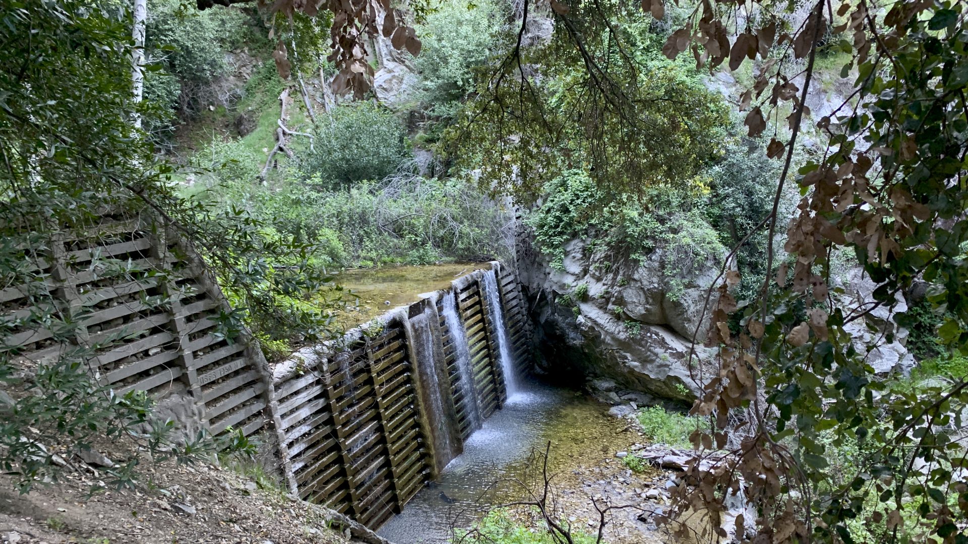
The Winter Creek trail eventually splits into Lower and Upper Winter Creek with both trails taking you back to the Chantry Flats parking lot. I hope to make it back up to this area and will definitely pick Upper Winter Creek next time. Lower Winter Creek rejoins the Sturtevant trail at the bridge and then you have to slog up the fire road for the last 0.5 mile. Upper Winter Creek is not that much longer but avoids the fire road on the way back. My legs would have appreciated that. 😅
It was a great day in the mountains – this hike is a little easier than the route via the Mt Wilson Trail since it has less gross elevation gain. I enjoyed the waterfalls, the shaded trail and the different route option. With multiple hike in campgrounds along the way it would be fun to come back and do an overnight along the creek.
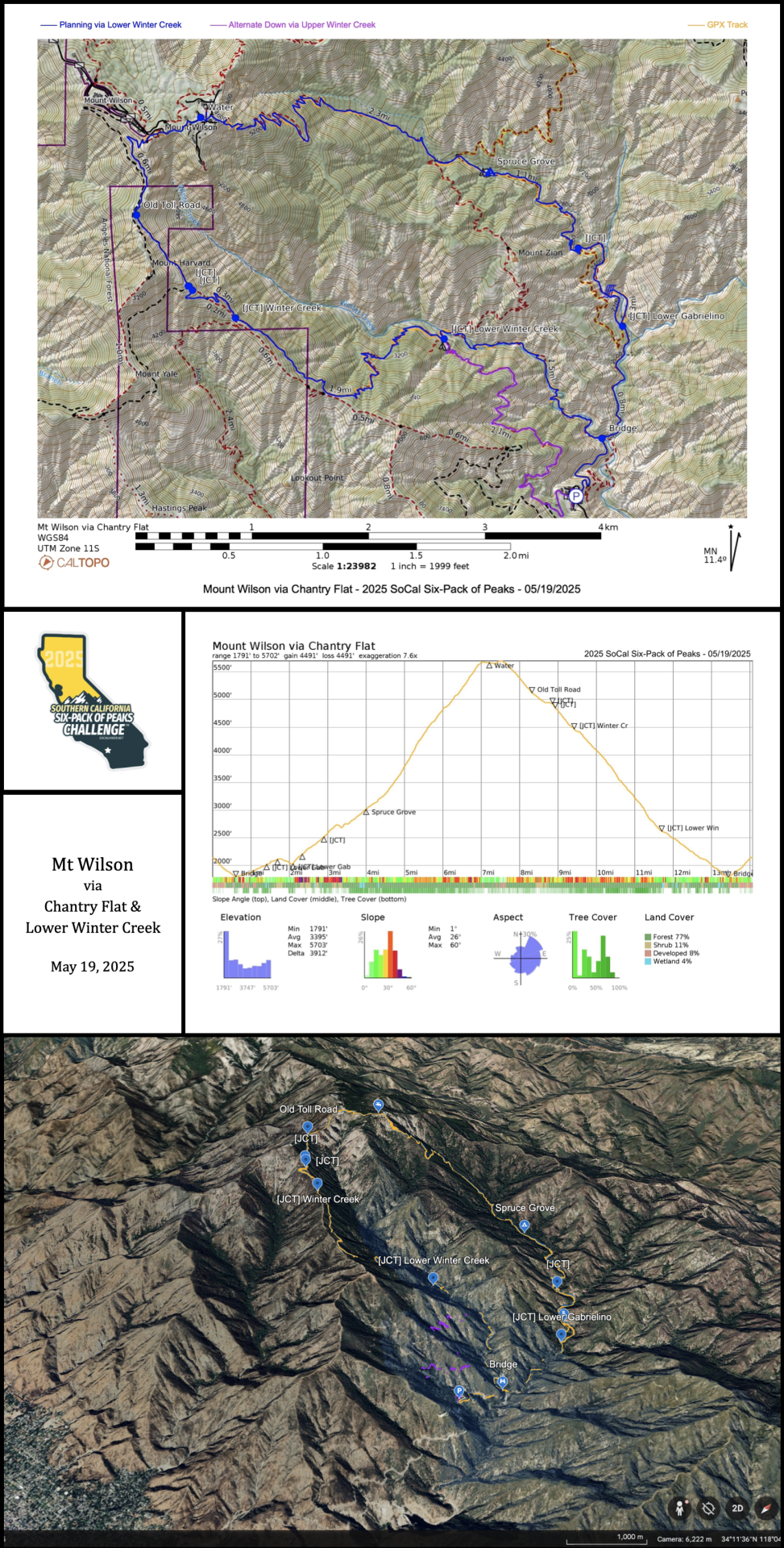
- Range: 968ft to 5702ft (vs 1791ft to 5702ft for the Mt Wilson route)
- Distance: ~14 miles (vs ~15 miles)
- Gross Elevation Gain: ~4490ft (vs 5725ft)
- Total Time: 7h15 (incl. stops for pictures + hang out time at the Sturtevant Falls & Observatory Complex)
Hike Logs (via Mt Wilson TH): 2024 | 2021 (w/ detailed map & track)
Responses