Bay Area Challenge Overview > The Peaks > Mount Sizer

Mount Sizer may be little more than a highpoint on the Blue Ridge, but getting there is what makes this hike a challenge. You’ll gain over 3,600 vertical feet in 15 miles, including a climb on one of the steepest trails in the Bay Area, affectionately called “The Shortcut.” Your legs will probably think of a better name for it. 😉
Did you know?
Henry Coe State Park is the largest in the California State Park system.
Mount Sizer Basics
- Summit elevation: 3,214′ (980 m)
- Vertical gain: 3,684′
- Hiking mileage: 15 miles
- Location: Henry W. Coe State Park
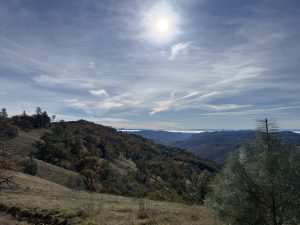
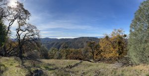
Hiking Mount Sizer
This loop hike gives you a grand tour that begins and ends at the park headquarters. There are several campgrounds along the route, so backpacking this loop is a viable option if you want to break it up over a couple of days. You’ll climb and descend several times, which accounts for the over 3,600 feet of vertical you’ll experience.
Trail Guides
Here are detailed trail guides to give you the information you need about each route:
- Hiking Mount Sizer Loop in Henry Coe State Park – via our sister site SoCalHiker
- Henry Coe: Mount Sizer – via Calipidder
Travel Time
- Drive time from San Francisco: 1 hour, 37 minutes (81 miles)
- Drive time from Oakland: 1 hour, 37 minutes (74 miles)
- Drive time from San Jose: 55 minutes (34 miles)
- Get turn-by-turn directions on Google Maps
Local Tips
- There is a day use fee, payable at the Visitor Center (open weekends) or at the “Iron Ranger” at other times.
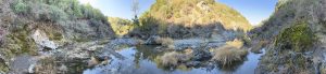
- This trail is hot and exposed. There may be water at Pahjuello Spring or Coyote Creek, but be prepared to filter before drinking.
Latest Mount Sizer Trip Reports
These hike logs will give you a feel for what the current conditions are, and the experience from other Six-Pack of Peaks challengers.

Sizer Out & Back Was Most Definitely a Challenge
Our group decided to do Sizer as an out and back to skip the dreaded “Shortcut,” but it was still quite a tough hike, with

Peak 5 of 6: Mount Sizer
I completed this hike for the Bay Area Six-Pack of Peaks challenge. This was a tough one & I was really feeling it during that
Saved the hardest for last!
Lived up to the hype. Out of all peaks attempted, this definitely tested our stamina. Was satisfying to get it done and under our belt.
The Hardest Mile of the Six-Pack on Mount Sizer
Took on Mount Sizer as the bonus seventh peak, and it absolutely lived up to the hype. Took the Monument Trail to Hobbs Road route
Frog Lake and Sizer Loop
Loved the hike! The 30 km loop with very steep ups and downs. Seen 2 coyotes and quite a few different birds. There was quite

 The Six-Pack of Peaks Challenge
This hike is part of the San Francisco Bay Area Six-Pack of Peaks Challenge, a series of challenging hikes up six, diverse and scenic Bay Area mountains. Sign-up to take the challenge today!
Got a link, tip or favorite aprés-hike restaurant we should add to this page? Let us know!