What’s The Frequency Kenneth? I’d say it Rather Hertz.
Also on this hike
In July, 2023, I solo-hiked in 86-90 degree Fahrenheit temperatures along a gravel covered road leading to several high points along the ridge of Smith Mountain. Conditions were favorable for a mid-afternoon hike with a light breeze, blue skies with large clouds in the distance and plenty of sun coverage from the trees along the forested trail.
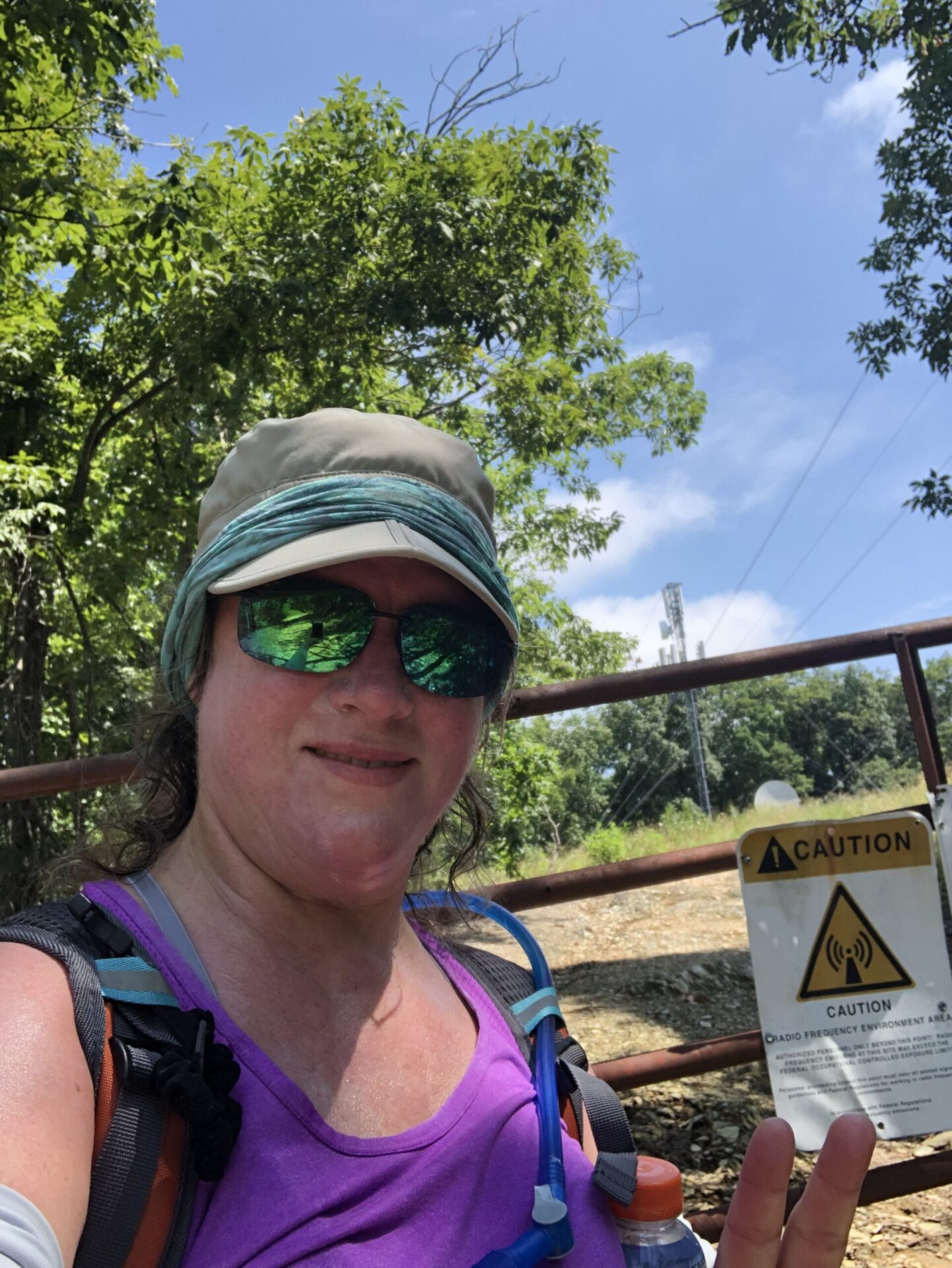
Approximately half-way along the trail is the namesake of this post, the Radio Tower. Fences and warning signs indicate to the community that the area surrounding the radio tower is unsafe and visitors are not allowed within 40 feet of the tower. Unknowingly, I surpassed the turnaround point and increased my hike by almost 1 mile. To forewarn other hikers, there is no summit that marks a turnaround, no dramatic viewpoint and no signage to indicate the end of the All Trails or Social Hiker route.
The gravel road trail is lined with wildflowers, ripened berries and flying insects hard at work transferring pollen. Among the flora and fauna were Red clover, blackberries, thorny and brightly colored thistle, Woodland sunflower, Hoary mountain mint, Goldenrod, Common milkweed, species of St. John’s -wort, mushrooms (possibly Amanita), Apheloria virginiensis (millipede), bumble bees and honey bees.
Birders will enjoy this trail as there will likely be few people when you take this trail. Keep dogs on a leash as this is black bear country as evidenced by scat and a freshly imprinted paw print in the mud I viewed on the main trail. The scat was likely from a bear and the print was from either a canine or a bear. I carried bear spray, a whistle and an airhorn for safety during the hike.
Sadly, graffiti and miniature figurines mark a high point of the Smith Mountain Trail, remember the fine principles of LNT. There are several high points along the trail measuring 2001 ft. and 1956 ft. and another high point near the radio tower.
The spur trail approximately 1.1 miles from the trailhead leads to occasional dramatic views below. This spur trail is known to locals for the fire tower, which I was aware of but completely missed out on. On my way back to the trailhead, nearly 7.5 miles into my hike, I traveled 1/2 mile along the spur trail before giving up and heading back to the main trail. I had spoken with two hikers who remarked that the views were obstructed by early morning clouds. Although the spur trail is not the main trail, views from this trail surpass any that are along Smith Mountain’s Jasmine road.
Use caution at the coordinates (36.99908, -79.57435). The center of the gravel road trail has a hole with sharp metal surrounding it. Use extreme caution at this hazard during winter (snow) and fall (leaves).
Most vehicles will have easy access to the trailhead parking along Jasmine Road which was easily identified by Google maps. The trailhead parking has ample parking based on the number of visitors to the trail. Keep in mind that after heavy rain, the roads may become more difficult to travel. Local summer residents asked me about permitting as they saw me place an extra copy of the permit on my dashboard.
Can I drive my vehicle to the top of Smith Mountain?
The road is open seasonally and for hunting. Jasmine road features up to 13% grade and I do recommend extreme caution if traveling this road when the gate is open for permitted visitors.
Do I need a permit? Appalachian Power Conservation Easement Permit is required to hike the summit of Smith Mountain.
As seen on dwr.gov website:
https://dwr.virginia.gov/access-permit/
The Virginia Department of Wildlife Resources (DWR) requires visitors who are age 17 and older to obtain an Access Permit for department-owned Wildlife Management Areas (WMAs), Wildlife Conservation Sites (WCSs), and public fishing lakes unless they possess a valid Virginia hunting, freshwater fishing, trapping license, current Virginia boat registration, or Restore The Wild membership.
The cost for the Daily Access Permit is $4 per person. The cost for the Annual Access Permit is $23 per person and both prices include the $1 per transaction license agent fee. Group discounts are available for daily use and the leader of the group must purchase the permit, carry it while on the property, and maintain a list of group participants for inspection when visited by a Conservation Officer.
All told, my version of this 7.4 mile hike took a little more than 9 miles with 1,942 ft of elevation gain and 5 hours of active hiking.
I camped for 2 nights at Smith Mountain Campground. A privately owned campground with sparkly clean toilets and large showers. Fireflies lit up the forest during the early evenings and campfires were permitted for an authentic southern USA camping vibe.


This was not an overnight hike. The hike was a day hike lasting 5 hours. I haven’t figured out how to change the data on a post. Didn’t want anyone to pack a tent for this short hike!