
Mild weather holding with highs still in the 70's whereas next weekend is projected to hit 100+ so I decided to get my final peak of the challenge in before summer hits us fully and the good run of a mild weather finally dries up.
Trail conditions were somewhere between “minor obstacles posing a few problems” and “trail difficult / impossible to navigate” (though I am sure this will vary based on personal experience).
Here's the breakdown:
- Miles: 14.7 miles
- Elevation Gain + 3,510 ft
- Elevation Loss -3,507 ft
- Conditions
- Temp: Highs in the 70's+ (approx 77 F), Low of 54 (did not experience this as I started the hike at noon
- Light wind, Good clear day
- Trail Conditions
- First 3+ miles fine, overgrowth tramped down by 4×4's, single track quite walkable. Some streams that are all but dried up with lots of algae and scum (you'll not want to slip) but all are quite easily rock-hoppable. Looks like people have taken some time to move bigger rocks into place that helps.
- Miles 4+, the growth gets thicker, thorny bushes quite present and will poke through regular pants. Boots and gaiters recommended (stuff still got in my shoes – definitely glad I left the trail runners at home).
- Near Mile 4.9 as you approach the dry creek bed, overgrowth of brush is considerable. Waist high or higher. You won't be able to see the trail often, it's easy to go off course. You have to bushwhack (or rather, push past a lot of bushes and branches) until you get the ridge. I heard a rattlesnake without being able to see it so watch your foot placement.
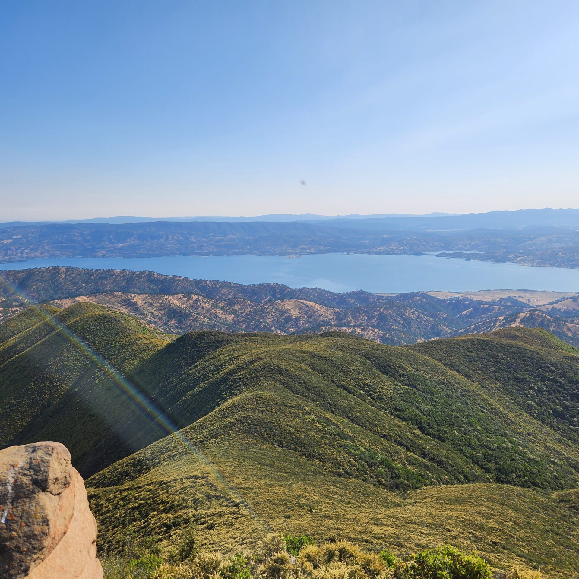
- The nicest view is on the ridge before you get to the fire road (Road 8053) that takes you to the summit.
- The summit itself has an array and installation, but there is a great ledge of rocks to take in the view from and have a summit snack.
- Note that Road 8053 mostly passes through private property.
- Summary:
- An out of the way hike for me but wanted to “get the full set” of peaks.
- Be careful. Expect to be slowed down. I had signal most of the hike but not all. I think this is still a very do-able hike but just be prepared for the trail conditions and brush growth. And the area will be much hotter going forward.


Responses
P.S. No water en route really with current water levels (unless you want to squeeze it out of algae and then treat it). There are a few trickles but they are hard to get to and are likely to dry up soon as well. Take all the water you need.
Clarification:
“Note that Road 8053 mostly passes through private property.” is with regards to taking it as a route down.
Did the hike on June 13th. and it was hard work.Right now I wouldn’t do it,getting hotter and more dangerous..If then in the fall maybe???
Completely agree (as far it being hard work and more dangerous in hotter weather). For me personally, I felt that this past weekend (Jun 25) was the last reasonable window in terms of weather. Would not attempt this next weekend (July 1) when the temperature is projected to be 104 F at Lake Berryessa and would have left until fall as well.
Great trip report, Ali. Thanks for the detail. This will hopefully dissuade folks from hiking it during the heat of summer (and set expectations for a brushy, tough hike when it does eventually cool off). Great shot of Lake Berryessa.