
Mission Peak
About this peak
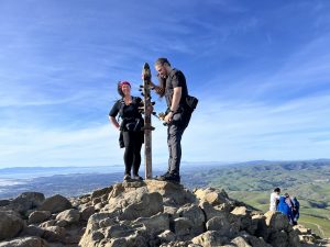
Mission Peak rises to 2,517 feet above Fremont on the southern arm of San Francisco Bay and offers a 360-degree panorama from San Jose to Mount Tamalpais, with the Sierra Nevada visible on clear days. The recommended Six-Pack route is the out-and-back Hidden Valley Trail from the Stanford Avenue Staging Area, about 6.2 miles with 1,992 feet of vertical gain. The route is almost entirely exposed, so carry plenty of water and start early, since weekends are crowded.
Know before you go
Hazards
The route is almost entirely exposed, so sun, heat, and UV are the main concerns; carry at least a liter of water, more in warm weather. Steep gravel sections can be slippery and a short rocky stretch near the summit needs careful footing. Cattle graze along the Hidden Valley Trail, so keep your distance. Weekends and holidays are very crowded, and the preserve closes at night with fines for being in the park after closing.
Join the Community to view parking and routes
Members get route details, parking and trail guides, and can log hikes toward badges.
Join the CommunityAlready a member? Log inHike logs from this peak
Log your hike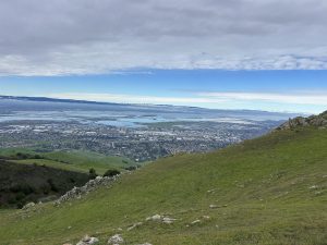
More peaks in this challenge
Sorted by elevation. Bars show summit elevation against the highest peak.
- Mount Saint Helena 4,341 ft
- Mount Diablo 3,849 ft
- Rose Peak 3,817 ft
- Mount Umunhum 3,486 ft
- Mount Sizer 3,215 ft
- Black Mountain 2,812 ft
- Mount Tamalpais 2,572 ft
- Mission Peak (you are here) 2,517 ft