
Black Butte (OR)
About this peak
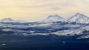
Black Butte is an extinct stratovolcano east of the Cascades that rises about 3,000 feet above the surrounding plain, topped by an active fire lookout tower and a historic cupola. The recommended route is the Hiking Black Butte (Upper Trailhead) guide, about 4.4 miles round trip with roughly 1,443 feet of gain, climbing steeply through ponderosa pine to open subalpine slopes. A longer 10.5-mile route from the lower trailhead is also listed. The summit views take in Mount Washington and the Three Sisters.
Know before you go
Hazards
The trail climbs steeply for about two miles and the trees thin out in the second mile, leaving the upper slopes open to sun and wind. Carry plenty of water, since none is listed along the route. Fire danger and public use fire restrictions apply in summer, and the lookout tower and cupola on the summit are not open to visitors. The trail is for hikers only, with no bikes or motorized use.
Join the Community to view parking and routes
Members get route details, parking and trail guides, and can log hikes toward badges.
Join the CommunityAlready a member? Log inHike logs from this peak
Log your hike

More peaks in this challenge
Sorted by elevation. Bars show summit elevation against the highest peak.
- South Sister 10,363 ft
- Mount Bachelor 9,068 ft
- Mount Bailey 8,330 ft
- Maiden Peak 7,805 ft
- Black Crater 7,251 ft
- Belknap Crater 6,876 ft
- Black Butte (OR) (you are here) 6,436 ft
- Tom Dick and Harry 4,997 ft
- Sutton Mountain 4,694 ft