
Sitton Peak
About this peak
At an elevation of 3,273 feet Sitton Peak is the lowest peak of the dozen, but conveniently close for Orange, Riverside and San Diego County residents. The hike is about 10 miles with 2,150 feet of gain, mostly on well-marked trail and fire road, and the 360-degree summit views reach the ocean and Catalina Island on a clear day. The last quarter mile is unmaintained and often overgrown, so wear long pants. There is no water on the trail and summers are hot, so fall through spring is the best time to go.
Know before you go
Hazards
There is no water on the trail and the area gets very hot in summer; fall through spring is the best season. The final quarter mile to the summit is unmaintained, steep and often overgrown, with some scrambling and bushwhacking, so wear long pants and watch for poison oak. There are several trail junctions, so bring a map. Ortega Highway is busy; cross it carefully.
Join the Community to view parking and routes
Members get route details, parking and trail guides, and can log hikes toward badges.
Join the CommunityAlready a member? Log inHike logs from this peak
Log your hike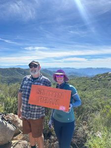


More peaks in this challenge
Sorted by elevation. Bars show summit elevation against the highest peak.
- San Gorgonio 11,503 ft
- Mount San Jacinto 10,834 ft
- San Bernardino Peak 10,649 ft
- Mount Baldy 10,064 ft
- Mount Baden-Powell 9,406 ft
- Cucamonga Peak 8,859 ft
- Sawmill Mountain 8,822 ft
- Ontario Peak 8,696 ft
- Strawberry Peak 6,164 ft
- Mount Wilson (San Gabriel Mountains) 5,713 ft
- Santiago Peak 5,689 ft
- Sitton Peak (you are here) 3,273 ft