SoCal Six-Pack of Peaks Challenge Modified for Valley Fire
UPDATE: On August 30, San Bernardino Peak has been reopened, including the San Bernardino Peak and Momyer Trails.
UPDATE: On August 15, the Vivian Creek trail and the South Fork trails to San Gorgonio reopened for hiking!
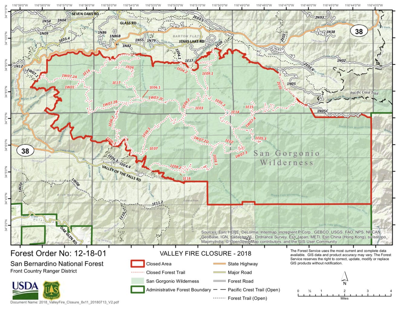
On Friday, July 13th (cue ominous music), the Forest Service issued Closure Order #12-18-01. This order closes the entire San Gorgonio Wilderness “until the Valley Fire is declared out.” No camping or hiking in any of the closed area is allowed. The ranger station is cancelling permits for August and it looks like the area will be closed “indefinitely.”
The impacted area includes both San Bernardino and San Gorgonio peaks, which many of our SoCal challengers still needed to complete their challenge. This has happened before, and is an unfortunate reality during wildfire season.
The good news is that we've already defined alternate peaks, and you can still earn your place on the Finisher's List. Beginning today, if you complete and log the following peaks, you will be awarded the Finisher's Badge:
- Mount Wilson
- Ontario Peak
- Cucamonga Peak
- Mount Baldy
- Mount Baden-Powell
- Mount San Jacinto
It's true that the mileage and the total vertical gain is less, but the intent of the challenge remains the same; providing six, great peak hikes that will challenge you and help prepare you for your next big adventure.
We are thankful for the brave firefighters who continue to work to extinguish the Valley Fire and keep people and property safe. We are hopeful that the trails in the San Gorgonio Wilderness will be reopened again when the danger has passed.
Stay safe out on the mountains, and happy trails!


How sad!!
Thanks for the update!
Thank you for the update! Thankful for all the firefighters! ??
So I’ve already completed Baldy, Baden-Powell, and San Bernardino. If I do San Jacinto and 2 of the other 3 I’m good?
Yep!
I already logged all six hikes with photos. How do I go about getting my finisher’s badge?
Too bad. Was looking forward to end the 6 peak challenge at St Gorgonio. I have used your GPX files and excellent trail descriptions so far. Do you have those as well for Ontario Peak and Mt Baden-Powell?
If we climb Mt Baden-Powell and Ontario this year, can we add San Bernadino & Gorgonio next year and post here???
I am having a hard time finding the information on the Mt. Baden-Powell and the Ontario peak hikes. How do I find that information on social hiker?
What information are you looking for? If your looking for the trailheads Baden-Powell is through Wrightwood and the start is at Vincent Gap. The trailhead for Ontario Peak is exactly the same as Cucamonga Peak but at Icehouse Saddle you go right instead of straight, you just follow the signs. To get any and all information that you need, including directions to the trailheads, you should download the AllTrails app. It will tell you everything you want to know. If you need more information let me know.
https://www.alltrails.com/explore/trail/us/california/vincent-gap-to-mount-baden-powell-via-pct
https://www.alltrails.com/explore/trail/us/california/bighorn-peak-and-ontario-peak
Thank you.
Your welcome. You really don’t need maps for either of these hikes. They are single trails and all well marked. The GAIA maps are good for wilderness hikes or other hikes that you might need if you get off trail. The AllTrails app also has GPS that works without cell coverage as does another app I use, MapMyHike. I have used both of these on over 100 hikes and never found the need for maps unless you think you need them.
I beg to differ, Ken. People get lost on their way to Cucamonga Peak every weekend. Yes, it should be pretty easy, but not everyone is aware of the trail junctions. I recommend that you ALWAYS bring a map, both paper and digital. What if something happens like a wildfire and you have to find a different route out of the wilderness than then one you came in by?
Also, GaiaGPS also allows you to download maps for offline use (no cell coverage). I typically make sure I download the maps for the trail I’ll be hiking, then at the trailhead, put my phone into airplane mode to conserve battery power.
I completely agree with Jeff. You just never know what might happen. On every hike I do, I always carry a waterproof Tom Harrison paper map (or other), a digital Tom Harrison map on my phone that tracks my position on the map (offline). I carry a compass and I create a details (laminated) card that gives me a very good sense of where I am on the trail (both distance from point to point and over all distance traveled). I even put the elevation gains from point to point. Overkill! Maybe, but I know I will never get lost or be unsure of any trail. 😉
Hi Judy! I’ve added links to our detailed guides on our sister site, SoCalHiker in the blog post above. These are much more detailed than on AllTrails, and as a challenger, you have access to the better maps available in GaiaGPS. I sent out an email last week to all challengers with a 3-month subscription to GaiaGPS. 😉
Thank you.
Hey guys Jacinto is now blocked out too. While it is not on fire they are not allowing any hikers in the area. I am bummed because I already bought my tram tickets!
I would see if you can get a rain check (a fire check?) on your tram tickets.
I am not worried about it! I just wanted to inform other hikers that this could last 30 days.
I also read that the tram will be closed from Sept 10 – Sept 30 for annual maintenance. Hoping the fire will clear and we can get that hike in by end of Aug!
Thank you all for your comments.
I am wanting to complete the 6pack challenge as well. So far I have the following peaks completed:
Cucamonga peak
Mt Baldy
Ontario Peak
San Bernardino Peak
I plan on doing Mt Baden-Powell, Mt Wilson, San Jacinto Peak & as a bonus, I’m adding Iron Mountain. Since San G is closed, will this suffice for completing the challenge?
Wait…San J is closed as well?!!…..
I read that the tram from San Jacinto Peak will be closed for maintenance September 10-30.
Is there an alternate for this hike?
Melinda, you can hike Mt San Jacinto from several other routes that do not require the tram, including the Marion Mountain or Humber Park trailheads.
Also, we now have a total of 12 peaks, so you can mix and match any six. Check the blog here for details.
Can you update what is still closed. Is it now just San Bernardino? Thanks Maureen
Maureen, if you look at the top of the post you’ll see it says “UPDATE”. San Gorgonio has reopened, but San Bernardino remains closed.
When I picked up my permit today for San Jacinto (3rd time) to complete the challenge I saw that San Bernardino and San Gorgonio opened back up. Do I now need to squeeze those two in by the deadline to complete the challenge even if I completed the alternative hikes?
Hi Carole! No — you can mix-and-match any of the six peaks. 😉